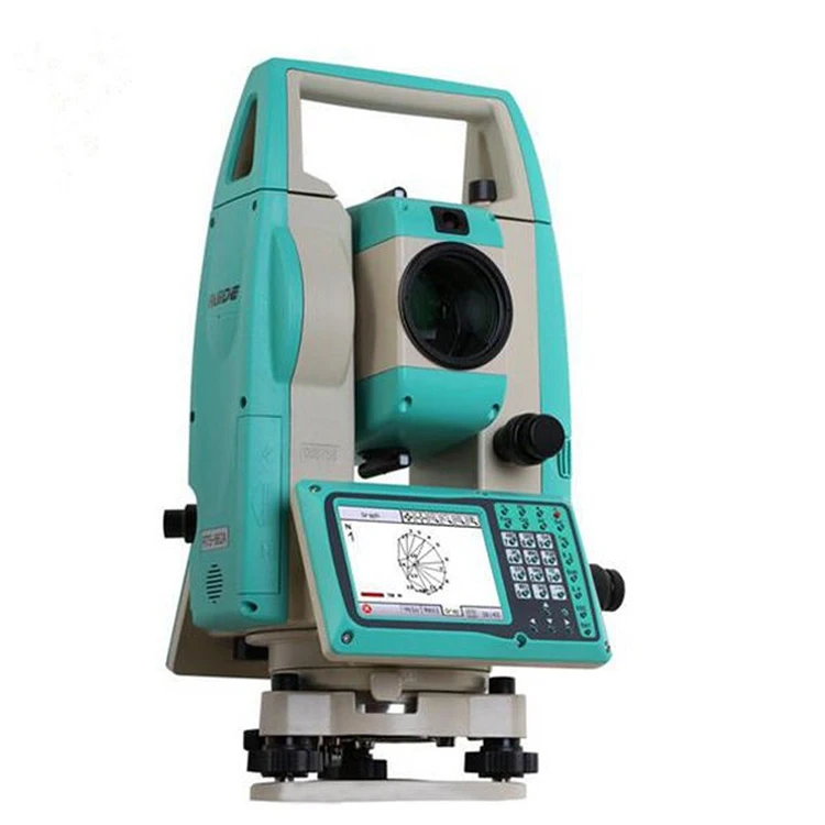
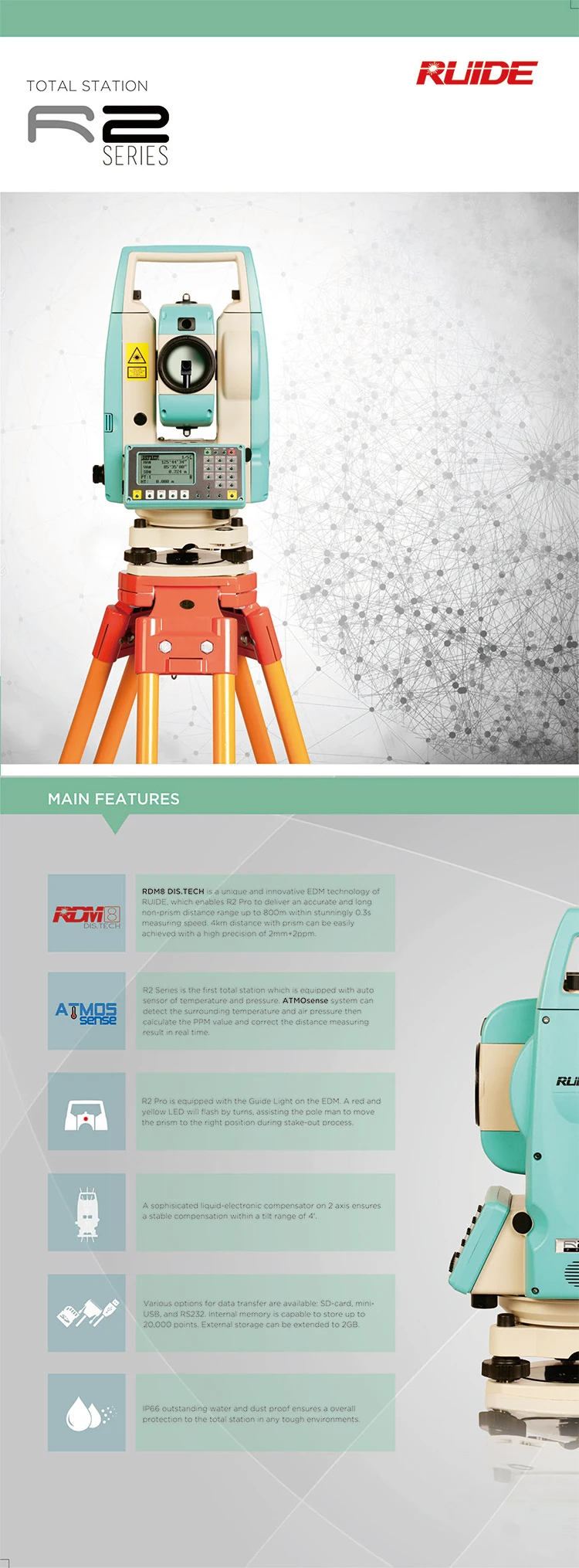
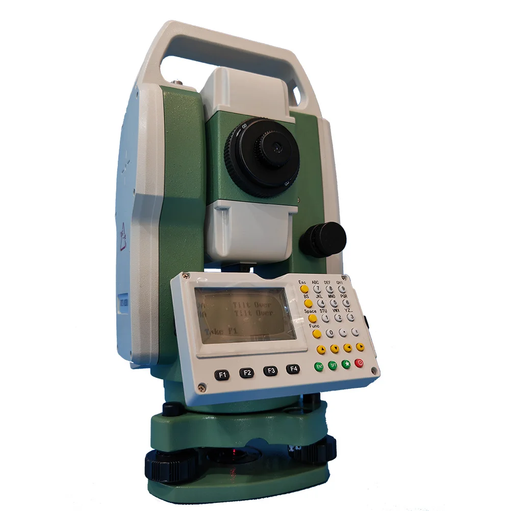
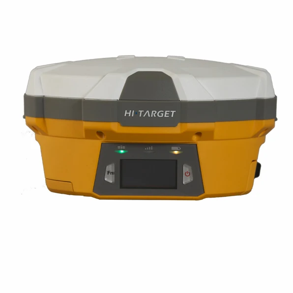
R2 GPS Total Station Data Collector
The R2 GPS Total Station Data Collector is a professional-grade surveying solution designed to work seamlessly with total stations and GPS systems. Built for accuracy, efficiency, and field durability, this device functions as a powerful collimator and data collector, enabling surveyors to capture, store, process, and transfer measurement data with precision. It is ideal for construction, land surveying, civil engineering, and topographic mapping projects.

📡 Integrated GPS & Total Station Compatibility
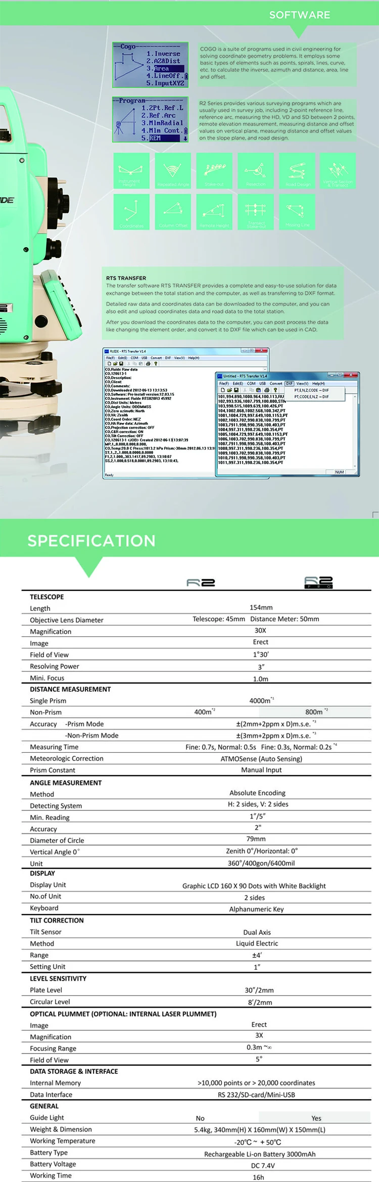
The R2 GPS Total Station Data Collector supports GPS positioning and total station integration, allowing surveyors to combine satellite data with optical measurements. This hybrid capability improves accuracy, reduces setup time, and ensures consistent results across large or complex survey sites.
🎯 Precision Collimator Function
Designed with a high-accuracy collimator system, the R2 ensures precise alignment and angle measurement when working with total stations. This feature minimizes human error during targeting and improves the reliability of horizontal and vertical angle readings, especially in demanding field conditions.

💾 Advanced Data Collection & Storage
The R2 GPS Total Station Data Collector allows real-time data recording, coding, and point management directly in the field. Survey data can be stored internally and later exported for use with CAD, GIS, and mapping software, streamlining office-to-field workflows.
📱 User-Friendly Digital Interface
Equipped with a clear digital display and intuitive interface, the R2 makes data input and navigation simple and efficient. The menu-driven system supports quick access to measurement functions, coordinate calculations, and project files, reducing training time for new users.
🏗️ Rugged & Field-Ready Design
Built to withstand harsh environments, the R2 GPS Total Station Data Collector features a rugged, dust-resistant, and weather-resistant housing. It performs reliably in hot, cold, wet, or dusty conditions, making it suitable for long-term outdoor use on construction sites and remote survey locations.
🔋 Long Battery Life for Fieldwork
Powered by a high-capacity rechargeable battery, the R2 supports extended working hours without frequent recharging. This ensures uninterrupted data collection during long surveying sessions and increases productivity on site.
🧰 Versatile Applications
The R2 GPS Total Station Data Collector is ideal for:
Land and boundary surveys
Construction layout and alignment
Road and infrastructure projects
Topographic and contour mapping
Engineering and industrial measurements
Its versatility makes it a valuable tool for surveyors, engineers, and field technicians.
⭐ Key Features
GPS-enabled data collection
Compatible with total stations
High-precision collimator function
Real-time data recording and storage
User-friendly digital interface
Rugged, weather-resistant design
Long-lasting rechargeable battery
Easy data export to CAD/GIS software
Compact and portable for field use
💎 Why Choose R2 GPS Total Station Data Collector
The R2 GPS Total Station Data Collector combines precision alignment, intelligent data handling, and GPS integration into one reliable device. It enhances accuracy, simplifies workflows, and improves efficiency for modern surveying tasks. Whether used on construction sites or large-scale mapping projects, the R2 delivers consistent, professional results you can trust.


Reviews
There are no reviews yet.